
What to see nearby
3
Researched for this guide and verified sight by sight — walk times below are measured from this stop.
Kawasaki Daishi (Heikenji)川崎大師 平間寺
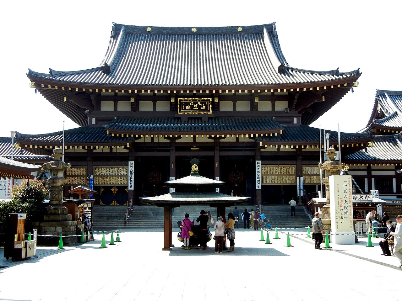
One of three head temples of the Chisan branch of Shingon Buddhism, founded in 1128 around an image of Kobo Daishi that a fisherman is said to have drawn from the sea. The branch line is its doing: Keikyu's first tracks opened in 1899 to carry pilgrims here. Great gate, main hall, Fudo hall and an octagonal five-storey pagoda share one precinct, and most who come are here for yakuyoke, the rite that turns misfortune aside.
≈8 min walkDaishi cho, Kawasaki Ward, Kawasaki, Kanagawa PrefectureSee on map →
Kawasaki Daishi Omotesando and Nakamise-dori川崎大師 表参道・仲見世通り
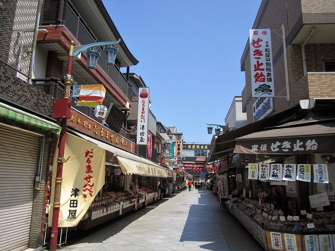
Two streets rather than one. The Omotesando starts at the station and runs east; the Nakamise — about two hundred metres — is the last stretch, squared up against the temple's main gate, with daruma sellers, kuzumochi makers and candy shops whose knives keep a steady tapping going as they cut. That tapping, heard through the crowd, put the approach on the Environment Agency's 1996 list of a hundred soundscapes worth keeping. Little here is old fabric: the wartime air raids took the prewar street, the merchants' cooperative rebuilt it, and since 2013 the city has reviewed new building along it against a townscape standard.
≈11 min walkDaishimachi, Kawasaki ward, Kawasaki, Kanagawa PrefectureSee on map →
Wakamiya Hachimangu and Kanayama Shrine若宮八幡宮・金山神社
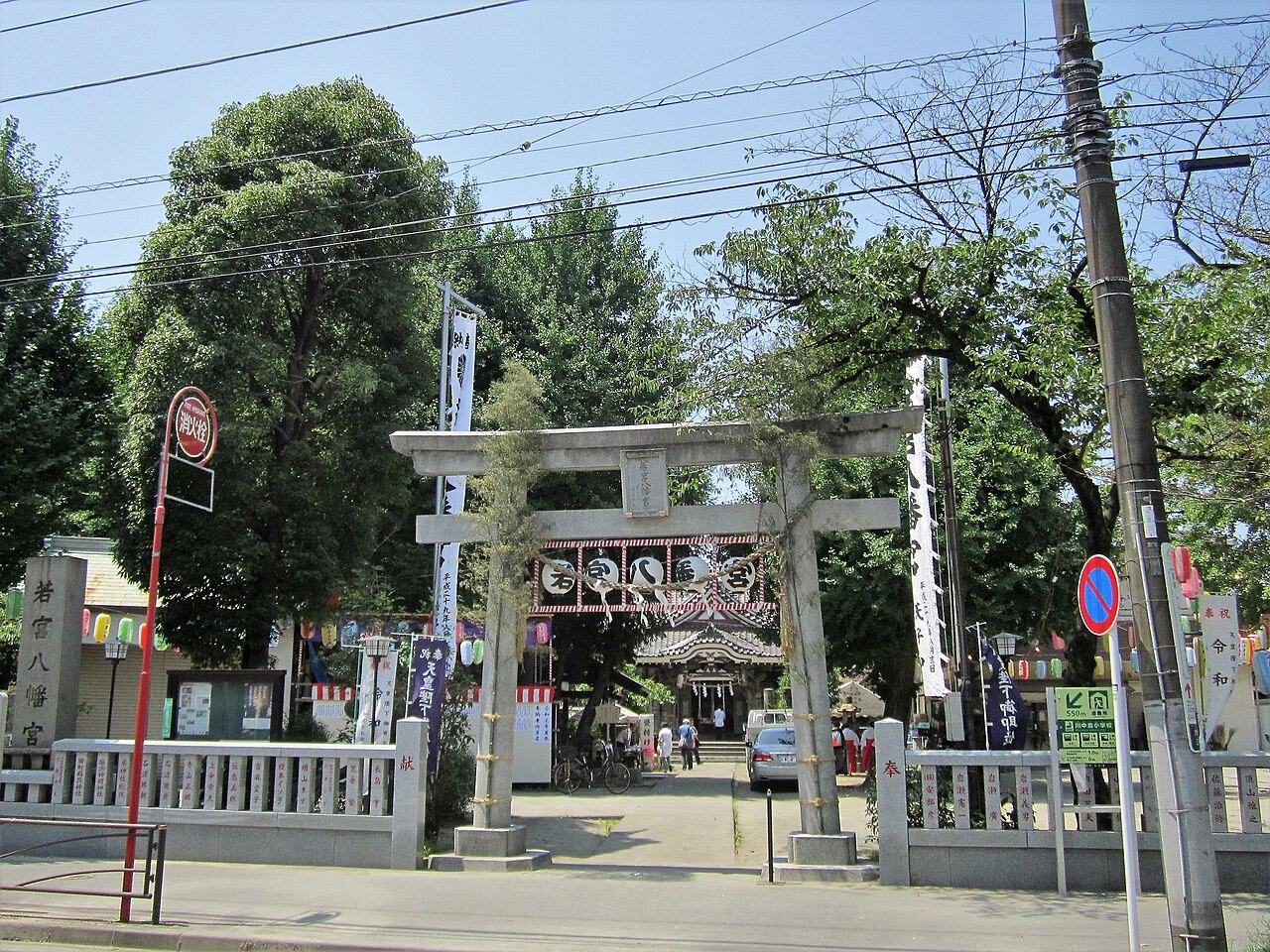
A shrine to Emperor Nintoku — Hachiman's young prince, which is what "Wakamiya" names — raised by settlers who crossed the Tama River to reclaim the river flats at Daishi. Its sub-shrine belongs to two gods of the forge and looks it: black steel plate outside, a bellows, a furnace and a sunken anvil on an earth floor within. Those same gods took charge of the body's lower half, and each April a phallic mikoshi goes out through the streets before a crowd drawn from well beyond Japan.
≈5 min walkDaishi Ekimae 2, Kawasaki ward, Kawasaki, Kanagawa PrefectureSee on map →


On this line
The number on the sign, and the stops either side.
- KK23
Share bikes
Docked share-bike ports a short walk away. Register in the operator’s app first — the dock itself sells nothing.
HELLO CYCLING川崎大師駅周辺自転車駐車場第2施設~30 m
HELLO CYCLING若宮八幡宮~120 m
HELLO CYCLINGセブンイレブン 川崎大師駅北店~140 m
Port locations and live availability are the operators’ own GBFS data — docomo bike share and OpenStreet (HELLO CYCLING) via the Public Transportation Open Data Center, CC BY 4.0. Ports can be full or empty at any moment; the app is the authority.
Not here yet
First and last train times aren’t here for this station. Check the official timetable.
- KeikyuKeikyu Daishi LineKEIKYU WEB ↗
Why some times are missing
Keikyu: the Public Transportation Open Data Center (ODPT) releases these station timetables under its Open Data Challenge licence, for contest entrants only, so this site cannot republish them.
Tokyo Metro, Toei and five other railways publish on terms this site can use, which is why their stations have times.
Exits aren't listed either. They come from OpenStreetMap, mapped by volunteers station by station, and this one's doors either aren't in it yet or are drawn without the numbers on the signs.
Which car to board still isn't here — it exists as posters on the platform and in no open dataset at all. Live service status covers the four Toei lines only, on their line pages: Tokyo Metro's feed is open data, but its terms don't allow passing it on the way this site delivers live information.