
Exits
Street exits by their posted numbers — the ones OpenStreetMap maps here, which is not always all of them. Marked exits have a step-free entrance.
Which exit for which sight
- 1National Diet Building≈3 min walk
- 2Japan’s Levelling Datum≈7 min walk
Of the exits listed here, the one with the shortest walk on foot, routed by us — not the operator’s own exit guide, which may send you a different way.
- 1
- 2
Step-free access
- Tokyo MetroB1FWheelchair-accessible · Ostomate · Baby change
- Tokyo MetroB2FWheelchair-accessible · Ostomate · Baby change
First and last train
Departures from this station. A time after midnight belongs to the night before — 00:20 means tonight, not tomorrow morning.
M-14Marunouchi Line
Ikebukuro
Every day05:12–00:06
Ogikubolast train ends at Shinjuku
Every day05:23–00:17
C-07Chiyoda Line
Kita-ayase
Weekdays05:12–00:12
Weekends & holidays05:12–00:07
Yoyogi-uehara
Weekdays05:27–00:36
Weekends & holidays05:27–00:18
What to see nearby
2
Researched for this guide and verified sight by sight — walk times below are measured from this stop.
National Diet Building国会議事堂
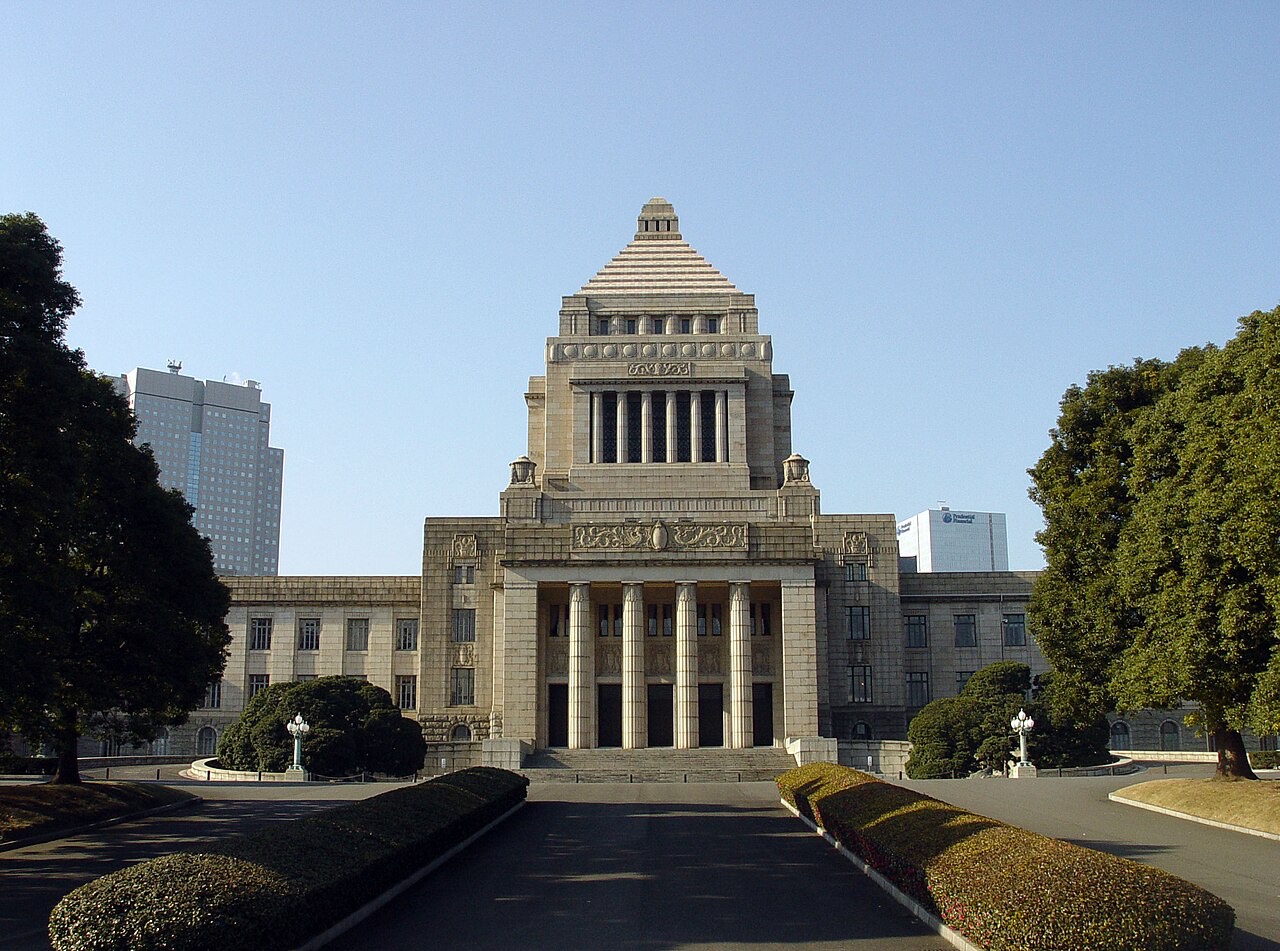
Japan’s parliament, seventeen years in the building and finished in 1936, faced in domestic granite under a 65-metre central tower; both houses run their own visits.
Exit 1≈3 min walkNagatacho 1, Nagatacho, Chiyoda, TokyoSee on map →
Japan’s Levelling Datum日本水準原点
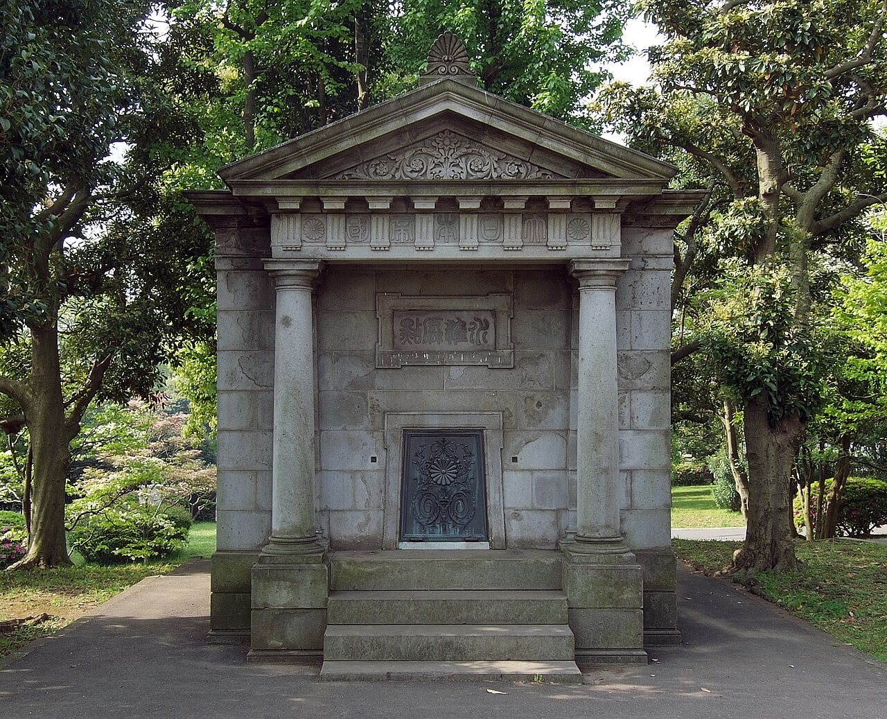
A small Doric stone house in the Diet’s front garden shelters the 1891 mark that heights across Japan are measured from.
Exit 2≈7 min walkTokyo Metropolitan Route 176, Nagatacho 1, Nagatacho, ChiyodaSee on map →
Geospatial Information Authority of Japan website国土地理院ウェブサイト ↗

Your lines here
This stop carries one number per line. The one on your sign depends on which platform you came up from.
- M14
- C07
Worth a stop nearby
Featured stops a few stations from here — same train, no change.
- M-16Ginza銀座Luxury flagships · Depachika2 stopstoward Ikebukuro
- C-09Hibiya日比谷Imperial gardens · Theatres2 stopstoward Kita-ayase
- M-17Tokyo東京Shinkansen gateway · Marunouchi3 stopstoward Ikebukuro
- C-04Omote-sando表参道Architecture · Boutiques3 stopstoward Yoyogi-uehara
- M-18Otemachi大手町Business core · 5-line transfer4 stopstoward Ikebukuro
Not here yet
Which car to board still isn't here — it exists as posters on the platform and in no open dataset at all. Live service status covers the four Toei lines only, on their line pages: Tokyo Metro's feed is open data, but its terms don't allow passing it on the way this site delivers live information.